 |
 |
 |
||||||||||||||||||||||||
| Philadelphia | ||||||||||||||||||||||||||
|
||||||||||||||||||||||||||
| Maps | |
|
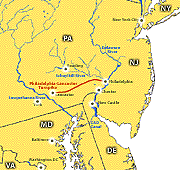
Estimated Population Density in 1803 Selected Roads in 1803 MODIS Image of Central Atlanitc Seaboard Nicholas King Northwest 1803 Map Philadelphia-Lancaster Turnpike Map | |
|
 |
|
|
|
|
|
|
| HOME |
|
|||||||||||||||||||||||||||||||||
|
|
||||||||||||||||||||||||||||||||
|
|||||||||||||||||||||||||||||||||