
PDF
Geologic Map of the Central and Lower Big Creek Drainage, Central Idaho Item Info
- Title:
- Geologic Map of the Central and Lower Big Creek Drainage, Central Idaho
- Creator:
- Steward, E.D.;Lewis, Reed S.; Steward, E.D.; Link, P.K.
- Date Created:
- 2013
- Description:
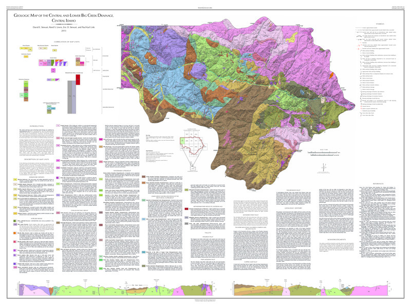
- This geologic map of the central and lower Big Creek drainage in central Idaho details the area's Mesoproterozoic to Quaternary rock formations, fault structures, and surficial deposits, compiled through extensive fieldwork conducted between 1995 and 2010.
- Subjects:
- map creeks (bodies of water) geology
- Source:
- Idaho Geological Survey
- Source Identifier:
- Stewart_etal_GeologicaMap_BigCreek_IdahoGeologicSurvey_2013
- Resource Type:
- map
- Type:
- Text
- Format:
- application/pdf
Source
- Preferred Citation:
- "Geologic Map of the Central and Lower Big Creek Drainage, Central Idaho", Taylor Wilderness Research Station Archive, University of Idaho Library Digital Initiatives
- Reference Link:
- https://www.lib.uidaho.edu/digital/taylor-archive/items/twrs556.html
Rights
- Rights:
- In Copyright, educational use permitted. Educational use includes non-commercial use of text and images in materials for teaching and research purposes. The University of Idaho Library is not liable for any violations of the law by users.