IMAGE
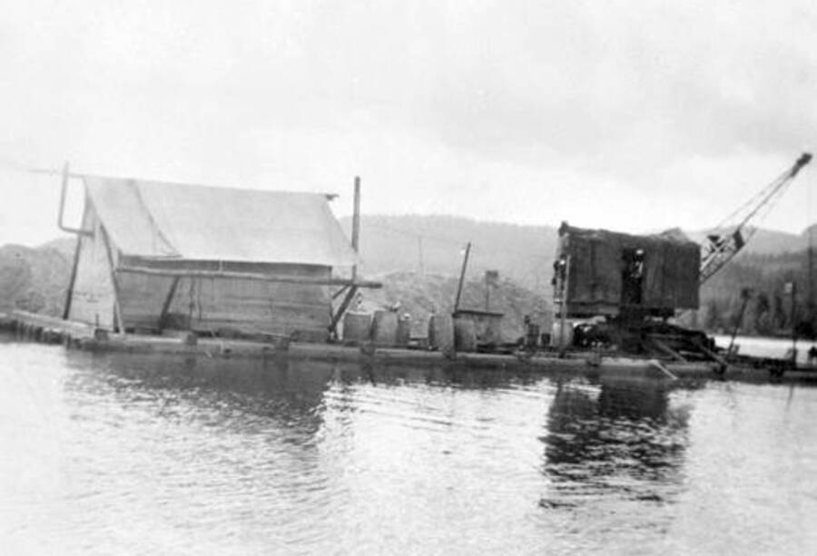
Dredging the Thorofare River Item Info
- Title:
- Dredging the Thorofare River
- Date Created (ISO Standard):
- 1932
- Description:
- View of dredging the Thorofare River which connects Priest Lake and Upper Priest Lake. Donated by H. J. Deiner through Priest Lake Museum.
- Subjects:
- dredging lakes (bodies of water)
- Latitude:
- 48.765551
- Longitude:
- -116.86492
- Source:
- Priest Lake Museum Association photographs, 1880-1950, PG 17, University of Idaho Library Special Collections and Archives
- Source Identifier:
- PG17-17-02
- Type:
- Image;StillImage
- Format:
- image/jpeg
Source
- Preferred Citation:
- "Dredging the Thorofare River", Priest Lake Historical Photograph Collection, University of Idaho Library Digital Collections, https://www.lib.uidaho.edu/digital/priestlake/items/priestlake41.html
Rights
- Rights:
- In copyright, educational use permitted. Educational use includes non-commercial reproduction of text and images in materials for teaching and research purposes. For other contexts beyond fair use, including digital reproduction, please contact the University of Idaho Library Special Collections and Archives Department at libspec@uidaho.edu . The University of Idaho Library is not liable for any violations of the law by users.
- Standardized Rights:
- http://rightsstatements.org/vocab/InC-EDU/1.0/

