
IMAGE
Surveying forest land Item Info
- Title:
- Surveying forest land
- Date Created (ISO Standard):
- 1953
- Approximated Date:
- yes
- Description:
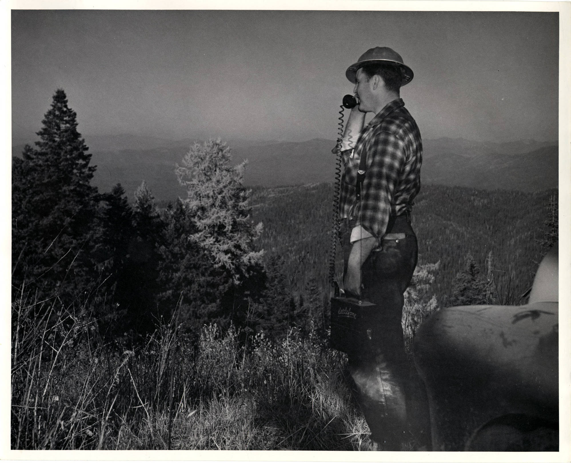
- The description on the back of the photograph reads 'Bob Tondevold surveys typical country from atop Bald Mountain. This is terrain which offers 'radar shows' and potential invasion path to enemy. Tondevold uses hand-carried battery-operated transmitter with which he can call in aircraft spotting information.' The writing on the transmitter says 'Littlefone'
- Subjects:
- transceivers forests (plant communities) hard hats
- Location:
- United States;Idaho;Blaine County;Bald Mountain
- Latitude:
- 46.575461
- Longitude:
- -115.899592
- Source:
- Potlatch Corporation Historical Archives, 1900-2007, MG 457, University of Idaho Special Collections and Archives
- Finding Aid:
- https://archiveswest.orbiscascade.org/ark:80444/xv40829
- Source Identifier:
- 457_202_31_006
- Type:
- image;stillimage
- Format:
- image/jpeg
Source
- Preferred Citation:
- "Surveying forest land", Potlatch Lumber Company Photograph Collection, University of Idaho Library Digital Collections, https://www.lib.uidaho.edu/digital/plcphotos/items/plcphotos1468.html
Rights
- Rights:
- In copyright, educational use permitted. Educational use includes non-commercial reproduction of text and images in materials for teaching and research purposes. For other contexts beyond fair use, including digital reproduction, please contact the University of Idaho Library Special Collections and Archives Department at libspec@uidaho.edu. The University of Idaho Library is not liable for any violations of the law by users.
- Standardized Rights:
- http://rightsstatements.org/vocab/InC-EDU/1.0/