IMAGE
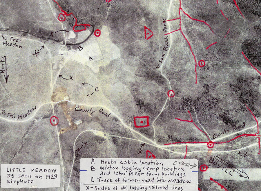
Map of Little Meadow Item Info
- Title:
- Map of Little Meadow
- Date Created (ISO Standard):
- 1933
- Description:
- Map of Little Meadow. A is Hobbs Cabin, B is Winton logging camp and latter Miller farm buildings, C is trace of former road into meadows, and X means grades of old logging railroad lines.
- Subjects:
- maps meadows
- Location:
- Bovill, Idaho
- Idaho County:
- Latah County
- Latitude:
- 46.859604
- Longitude:
- -116.393459
- Source:
- Latah County Historical Society, Moscow, ID, http://www.latahcountyhistoricalsociety.org/
- Source Identifier:
- 02-03-031-map
- Type:
- Image;StillImage
- Format Original:
- color photographs
- Format:
- image/jpeg
Source
- Preferred Citation:
- "Map of Little Meadow", Bovill Historical Photograph Collection, University of Idaho Library Digital Collections, https://www.lib.uidaho.edu/digital/lchsphotos/items/lchsphotos108.html
Rights
- Rights:
- Educational use includes non-commercial use of text and images in materials for teaching and research purposes. Digital reproduction permissions granted by Latah County Historical Society. For other uses beyond Fair Use, please contact University of Idaho Library Special Collections and Archives Department at libspec@uidaho.edu.
- Standardized Rights:
- http://rightsstatements.org/vocab/InC-EDU/1.0/

