
IMAGE
Map of Central Idaho Item Info
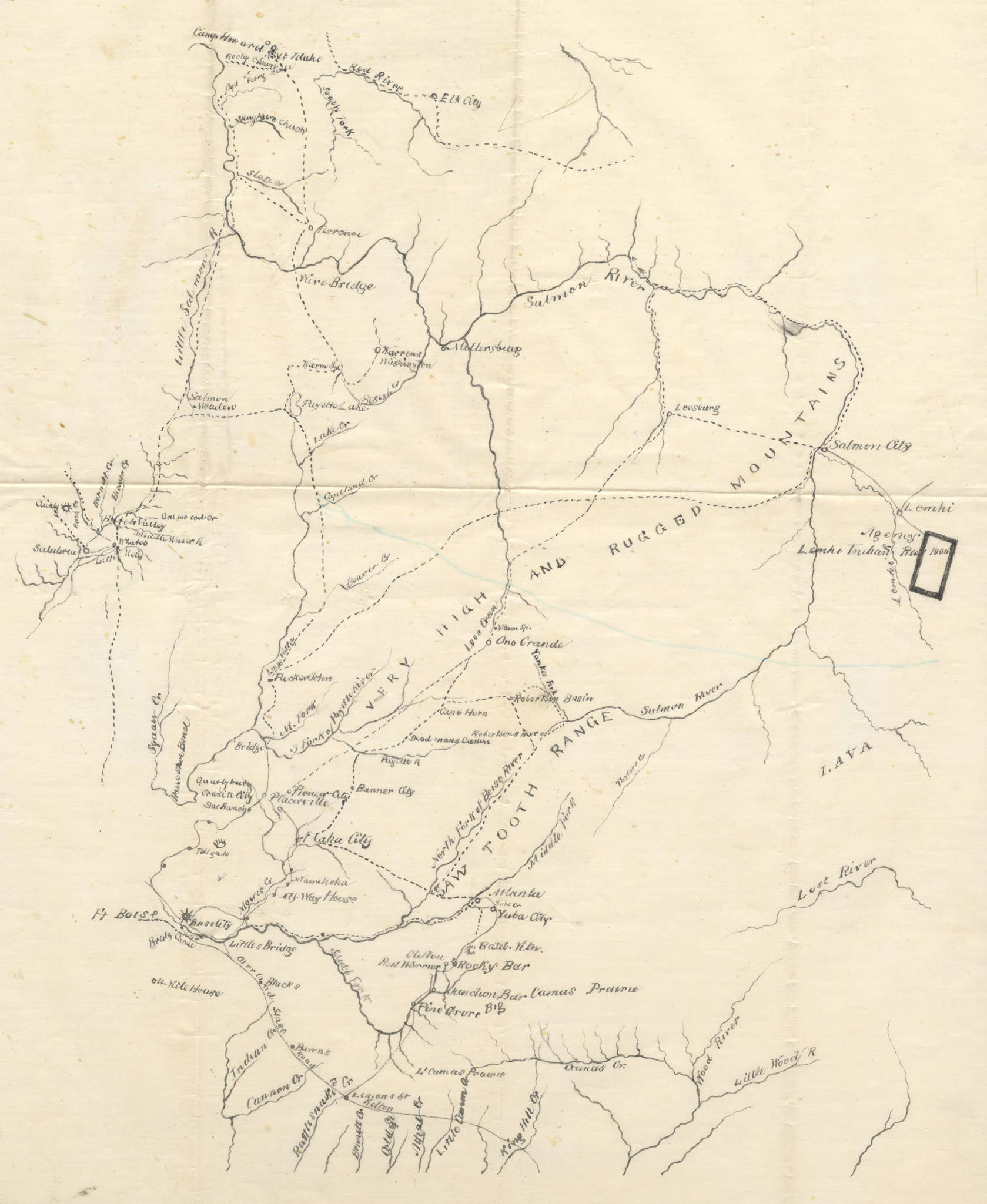
- Title:
- Map of Central Idaho
- Creator:
- Crandall, F.
- Date Created (ISO Standard):
- 1900
- Description:
- Map of central Idaho, emphasizing geographic features.
- Subjects:
- maps (documents)
- Location:
- Idaho
- Latitude:
- 44.771719
- Longitude:
- -115.458701
- Source:
- Collection on Stanton G. Fisher, 1877-1988, MG 454, University of Idaho Library Special Collections and Archives
- Finding Aid:
- https://archiveswest.orbiscascade.org/ark:80444/xv28329
- Source Identifier:
- MG454_01_02_04
- Type:
- Image;StillImage
- Format:
- image/jpeg
Source
- Preferred Citation:
- "Map of Central Idaho", Stanton Gilbert Fisher Collection, University of Idaho Library Digital Collections, https://www.lib.uidaho.edu/digital/fisher/items/fisher285.html
Rights
- Rights:
- Material has likely passed into public domain. Digital reproductions are made available by University of Idaho Library for educational purposes, and future use should acknowledge this repository. For more information, please contact University of Idaho Library Special Collections and Archives Department at libspec@uidaho.edu. The University of Idaho Library is not liable for any violations of the law by users.
- Standardized Rights:
- http://rightsstatements.org/vocab/NoC-US/1.0/