
IMAGE
Aerial survey of historical Boise Airport, shaded Item Info
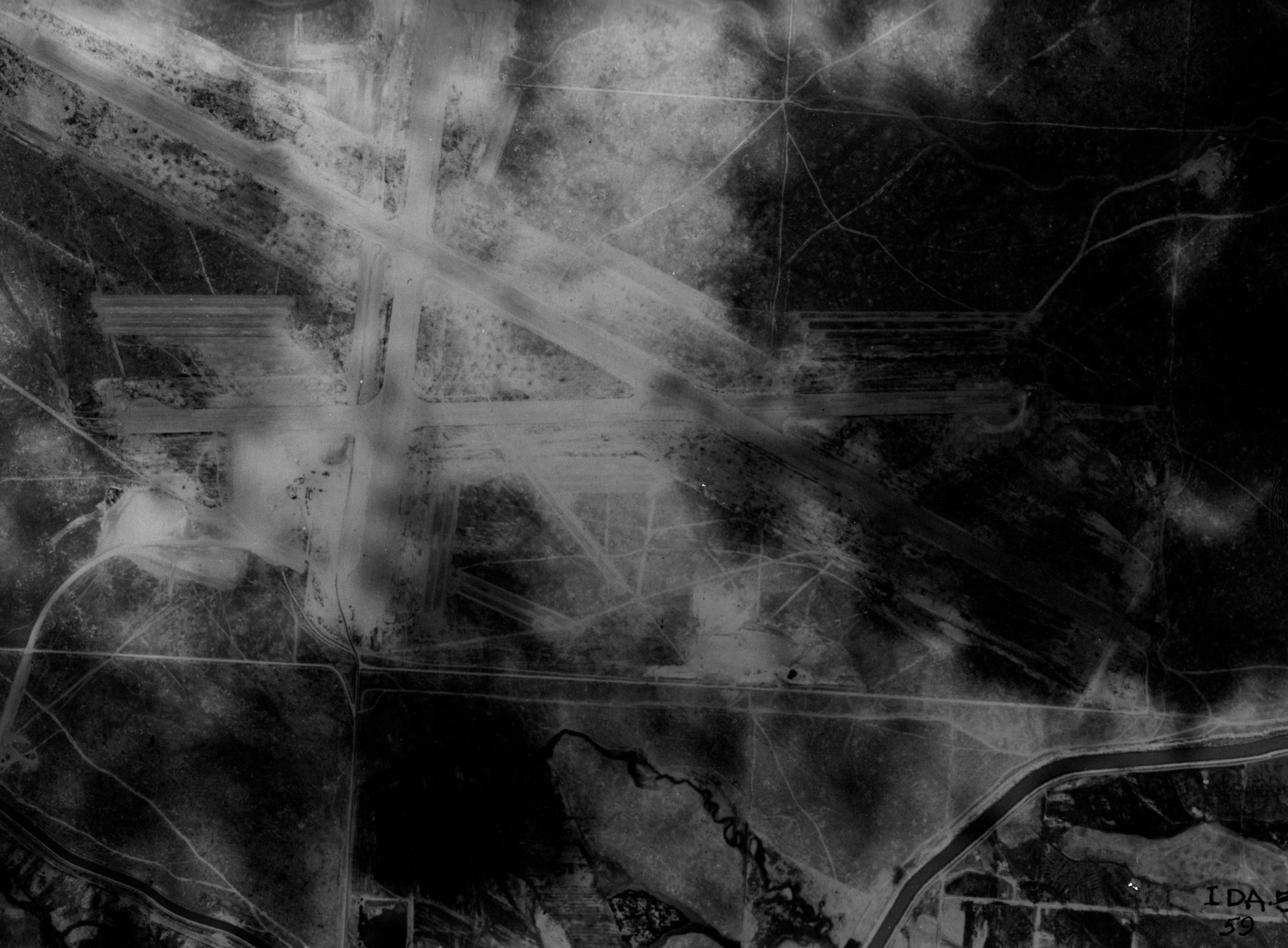
- Title:
- Aerial survey of historical Boise Airport, shaded
- Date Created (ISO Standard):
- 1935
- Description:
- Aerial image and survey of historical Boise Airport near Boise River, the current site of Boise State University
- Subjects:
- airport air strip landing field runway city aerial survey
- Location:
- Boise, Idaho
- Idaho County:
- Ada County
- Latitude:
- 43.60294
- Longitude:
- -116.19845
- Source Identifier:
- NARA10StlPht7
- Type:
- image;stillimage
- Format:
- image/jpeg
- Language:
- eng
Source
- Preferred Citation:
- "Aerial survey of historical Boise Airport, shaded", Archival Idaho Photograph Collection, University of Idaho Library Digital Collections, https://www.lib.uidaho.edu/digital/archivalidaho/items/archivalidaho1128.html
Rights
- Rights:
- Material determined to be in Public Domain based on date of publication. Material made available by the University of Idaho Library. Please note these materials are not held by University of Idaho Library Special Collections and Archives. For more information, please contact the institution listed in the Source.
- Standardized Rights:
- http://rightsstatements.org/vocab/InC-EDU/1.0/