Historical Air Photo Collection
Unmaintained Page: this page is not being updated and information may be significantly out of date.
Digitized Air Photos | Other Sources for Idaho Air Photos | Useful Links

Guide to Aerial Photographs (pdf) | Index to Aerial Photographs (xls) (.csv)
Location
- Library Map Room, 1st floor
- air photos are housed in file cabinets on the south edge of the Map Room; enlarged prints are housed in flat map cabinets along the west edge of the Map Room
- many digitized air photos are also available through University of Idaho Library Digital Collections
What We Own
- photos taken by government agencies (Forest Service, Corps of Engineers, Soil Conservation Service, etc.)
- entire collection has been donated to UI; all parts of the collection are incomplete
- 90% of the collection is of Idaho; the rest is of river valleys of the Snake and upper Columbia
- about 80% of photos are black and white, 8"x10" prints, taken vertically
- some color images (Clearwater National Forest) and some enlargements (mostly Latah and Nez Perce counties)

How to Use the Collection
- the air photo collection is not browsable according to a single scheme; an index sheet must be used
- most of the collection is indexed using the Aerial Photo index (.xls or .csv)
- the largest set of photos, donated by the Walla Walla District of the Army Corps of Engineers, is searchable using a printed keyword index prepared by the ACE
- they are arranged by the year of the photography, then by the river valley name; as a consequence, they are not easy to use
- most Soil Conservation Service photography is indexed by photo-mosaic index sheets (essentially a series of large photos of the small air photos all assembled together; a picture of pictures)
- most Forest Service photography is indexed by maps of forests with flight lines and picture numbers drawn on the map
- index sheets are located in various cabinets and cases and may be located using the Aerial Photo index; Index entries with an asterisk (*) identify mosaic sheets
Digitized Air Photos
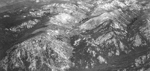
Oblique Photography
- coverage includes portions of Idaho north of the Salmon River, Sawtooth Mountains, and the Hells Canyon region
- these are on CDs available at the Circulation Desk in the library and are listed in the library catalog
- Special Collections also owns a small collection of oblique air photos of northern Idaho taken between 1933 and 1935 by the Washington National Guard
Idaho Historic Air Photo Project
- project conducted with the US Forest Service
- located all known air photos of Idaho north of the Salmon River taken before 1940, then scanned them at 300 dpi and stored them on CD-ROM
- these photos are not in mosaic form and are not georeferenced
- all vertical with the exception of the Washington National Guard oblique project (see above)
- each set is cataloged in the UI Library Catalog
- the last CD of each set generally includes a scanned version of the appropriate index sheet
- in a few cases, a paper index (obtained from the Cartographic Branch of the National Archives) is located in the SW corner of the map room
Digital Air Photos
- the UI Library has been a pioneer in assembling two very large air photo collections of Idaho
- both of these collections are very recent and in high resolution; some are in color; coverage of almost 100% of Idaho
- these are available through University of Idaho Library Digital Collections
Copying/Checking Out Photos

- these photos can be scanned and photocopied, and are not copyright
- we are happy to make short term loans of individual pictures to all members of the UI community
- the Library is not equipped to handle outside requests for photos of particular spots. Instead, we are happy to show visitors to the library the location of the various projects and index sheets that we own, and to explain how to make copies
Other Sources for Idaho Air Photos
- the Boise State University Library has completed part of an effort to locate and digitize pre-1940 photography of Idaho south of the Salmon River
- the Potlatch Corporation owns a very large collection of air photos, taken over many years, of their forest lands in northern Idaho
- the Cartographic Branch of the National Archives (located at Archives II in College Park, Maryland) is theoretically the final home for negatives of all USDA photography. Budget constraints at this agency, however, make it necessary to make a personal visit to College Park to locate needed photos
- most early photography of Idaho by the US Geological Survey was taken after 1946. We own a small collection of this USGS photography, which was used to help produce the 1:24,000 scale topographic maps of the Survey. The rest is located at the EROS Data Center in South Dakota
Other Useful Links
- Inside Idaho has flight line indexes identifying Idaho area aerial photos scanned and stored on CD's which are available to users at the Library Circulation Desk
- Inside Idaho also has Idaho aerial photos that can be viewed and visually compared online.
- the USGS provides name and geographic feature indexes which can be helpful in identifying specific locations on aerial photos, especially linking users to 1:24,000 Topo Map names, coordinates, and other information
- the USGS Earth Explorer provides access to satellite, topographical, and terrain map information for specific areas
![University of Idaho Library [logo]](https://www.lib.uidaho.edu/media/images/ui_library_horizontal.png)